The Dordogne and Lot valleys
Castles and cliff villages along two rivers of south-west France. The trip starts where the Vézère meets the Dordogne at Limeuil, then follows the river past Beynac, Castelnaud, La Roque-Gageac and Domme. A detour north reaches the red sandstone of Collonges-la-Rouge and the castle hill of Turenne, and the last days run through the Quercy to Rocamadour and Saint-Cirq-Lapopie, high above the Lot.
.jpg/500px-Dordogne_%C3%A0_Limeuil_(1).jpg)



Day by day
Driving times are approximate, from OpenStreetMap roads without traffic; long legs are rougher estimates. The Google Maps links give up-to-date times.
Day 1
- Bordeaux AirportLeaving from
- ~2 h 35 driving · 194 km
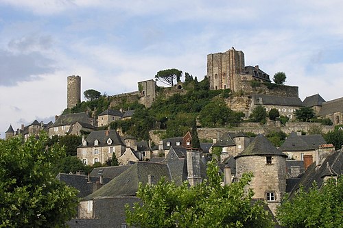
.jpg/120px-Dordogne_%C3%A0_Limeuil_(1).jpg) LimeuilNouvelle-Aquitaine
LimeuilNouvelle-Aquitaine Overnight in Limeuil
Day 2
- ~35 min driving · 30 km
 Beynac-et-CazenacNouvelle-Aquitaine
 - ~5 min driving · 4 km
 Castelnaud-la-ChapelleNouvelle-Aquitaine
 - ~5 min driving · 4 km
 La Roque-GageacNouvelle-Aquitaine
 - ~10 min driving · 9 km
 DommeNouvelle-Aquitaine
 Overnight in Domme
Day 3
- ~1 h 15 driving · 70 km
 Collonges-la-RougeNouvelle-Aquitaine
 - ~10 min driving · 10 km
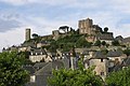 TurenneNouvelle-Aquitaine
 - ~30 min driving · 24 km
 CarennacOccitania
 Overnight in Carennac
Day 4
- ~35 min driving · 27 km
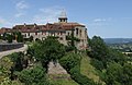 LoubressacOccitania
 - ~10 min driving · 5 km
 AutoireOccitania
 - ~35 min driving · 30 km
 RocamadourOccitania
 Overnight in Rocamadour
Day 5
- ~1 h driving · 56 km
 Saint-Cirq-LapopieOccitania
 - ~1 h 50 driving · 129 kmToulouse AirportReturning to