Apulia, from the Gargano to Salento
Apulia from top to toe in a week. The trip begins on the Gargano promontory at Monte Sant'Angelo, with its cave sanctuary of St Michael, and Vico del Gargano, then crosses to the Daunian mountains at Alberona and Bovino. Gravina in Puglia stands on the edge of a deep ravine, and Locorotondo and Cisternino are whitewashed towns in the trulli country of the Itria valley. Maruggio, near the Gulf of Taranto, and Specchia lead to Otranto, the easternmost town in Italy, before the trip ends at Brindisi.


_4.jpg/500px-Gravina_in_Puglia_(BA)_4.jpg)


Day by day
Driving times are approximate, from OpenStreetMap roads without traffic; long legs are rougher estimates. The Google Maps links give up-to-date times.
Day 1
- Bari AirportLeaving from
- ~2 h driving · 139 km
 Monte Sant'AngeloApulia
 - ~55 min driving · 46 km
 Vico del GarganoApulia
 Overnight in Vico del Gargano
Day 2
- ~2 h 30 driving · 133 km
 AlberonaApulia
 Overnight in Alberona
Day 3
- ~1 h 15 driving · 61 km
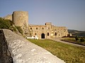 BovinoApulia
 Overnight in Bovino
Day 4
- ~1 h 55 driving · 128 km
_4.jpg/120px-Gravina_in_Puglia_(BA)_4.jpg) Gravina in PugliaApulia
Gravina in PugliaApulia Overnight in Gravina in Puglia
Day 5
- ~1 h 45 driving · 92 km
 LocorotondoApulia
 - ~15 min driving · 12 km
 CisterninoApulia
 Overnight in Cisternino
Day 6
Day 7
- ~45 min driving · 39 km
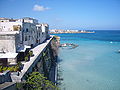 OtrantoApulia
 - ~1 h 15 driving · 84 kmBrindisiReturning to