Corsica and Sardinia
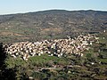
Two islands in one trip, joined by the short ferry from Bonifacio to Santa Teresa Gallura. In Corsica, Sant'Antonino crowns a hill above the Balagne, and Piana looks over the red granite cliffs of the Calanques on the Gulf of Porto. From Piana, the drive south over the mountains to the ferry at Bonifacio is a long drive. In Sardinia the route runs from Tempio Pausania, among granite and cork oaks, to Castelsardo on its headland and Bosa on the banks of the Temo, then crosses the island's mountainous centre at Atzara and Sadali before ending at Cagliari.


.JPG/500px-Tempio_Pausania_-_Costume_tradizionale_(11).JPG)
.jpg/500px-Castelsardo%2C_panorama_(01).jpg)
.JPG/500px-Bosa_-_Costume_tradizionale_(01).JPG)


Day by day
Driving times are approximate, from OpenStreetMap roads without traffic; long legs are rougher estimates. The Google Maps links give up-to-date times.
Day 1
- Bastia AirportLeaving from
- ~1 h 30 driving · 87 km
 Sant'AntoninoCorsica
 Overnight in Sant'Antonino
Day 2
- ~1 h 45 driving · 99 km
 PianaCorsica
 Overnight in Piana
Day 3
- Ferry or flight needed
.JPG/120px-Tempio_Pausania_-_Costume_tradizionale_(11).JPG) Tempio PausaniaSardinia
Tempio PausaniaSardinia - ~50 min driving · 50 km
.jpg/120px-Castelsardo%2C_panorama_(01).jpg) CastelsardoSardinia
CastelsardoSardinia - ~2 h driving · 121 km
.JPG/120px-Bosa_-_Costume_tradizionale_(01).JPG) BosaSardinia
BosaSardinia Overnight in Bosa
Day 4
Day 5
- ~1 h 20 driving · 90 kmCagliari AirportReturning to